







As tensions between Washington and Tehran escalate, the Strait of Hormuz has effectively fractured into two distinct maritime corridors. US President Donald Trump has maintained that his military holds authority over the waterway, recently asserting that the strait remains open for transit despite Iranian claims that the passage is restricted to vessels authorized by Tehran. Simultaneously, the US has implemented a naval blockade, while Trump has issued threats against Oman, a US ally situated along the southern side of the strait.
Amidst these competing claims of control, maritime intelligence firm Kpler has analyzed traffic patterns between August 1 and August 19 to determine how commercial vessels are navigating the conflict. The data reveals a significant trend: rather than choosing between the northern Iranian route or the southern Omani route, the vast majority of ships are choosing to disappear from official tracking systems.
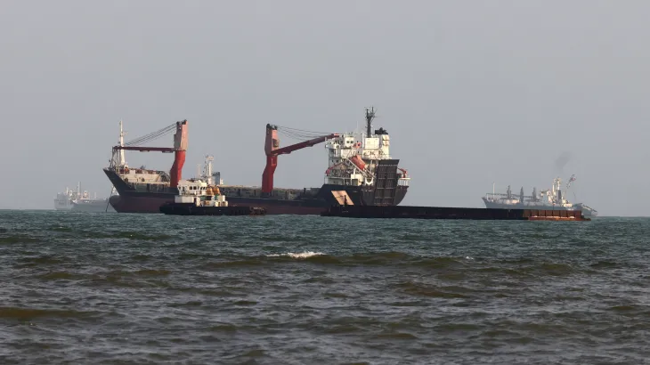
Between August 1 and August 19, a total of 112 vessels carrying crude oil, liquefied petroleum gas (LPG), and liquefied natural gas (LNG) transited the strait. Of these, only 21 ships openly utilized the Iranian route, while a mere two vessels formally declared their use of the Omani route. The remaining 89 vessels—accounting for more than 80 percent of all oil and gas traffic during this period—opted for “dark” or unclassified routing. This practice involves disabling Automatic Identification System (AIS) transponders to mask a vessel’s identity and precise location.
When looking at broader maritime traffic, including cargo ships, the trend remains consistent. Kpler recorded 236 total transits during the same 19-day window. Of those, 83 ships used the Iranian route, three used the Omani route, and two followed the pre-war central channel. However, 148 vessels—more than 60 percent of the total traffic—navigated the strait using dark or unknown routes. This indicates that roughly 35 percent of vessels openly adhered to the Iranian route, while public use of the Omani or pre-war routes remains minimal.
The prevalence of dark routing is largely a response to the military risks posed by both sides. Since the conflict began, both the US and Iran have engaged in strikes against vessels they accuse of violating their respective maritime navigation rules. On August 11, the US Navy reported firing two Hellfire missiles at the Panama-flagged cargo vessel Vela Nova, alleging it failed to follow orders to change course while attempting to reach Iranian ports. Last month, the US also targeted an oil tanker heading toward Kharg Island.
Iran has been equally aggressive. On August 8, the United Arab Emirates reported that a missile attack, attributed to Iran, struck a tanker owned by the Abu Dhabi National Oil Company (ADNOC). ADNOC stated that 15 of its vessels have been targeted by drones and missiles since the war’s inception. Beyond security, experts note that dark routing is also used to facilitate ship-to-ship cargo transfers, allowing countries like Saudi Arabia, Iraq, and Kuwait to move shipments discreetly. Furthermore, Iranian vessels have been observed using the Omani route to conduct transfers, effectively rebranding shipments to bypass international sanctions.
The economic impact of these tensions is reflected in global energy markets. Before the conflict, Brent crude was priced at approximately $66 per barrel. As hostilities intensified, prices surged, peaking at $119 in March and hitting $100 on multiple occasions, most recently on July 23. As of Thursday morning, Brent crude was trading at $92.9 per barrel.
Ultimately, the data suggests that while Iran retains the capacity to disrupt maritime traffic, the widespread use of dark routing makes it difficult to conclude which power holds definitive control. Analysts suggest that if Tehran’s ability to influence shipping flows is perceived to be waning, it could diminish a key source of leverage in future negotiations with the United States. For now, commercial operators appear to be prioritizing evasion over compliance, betting that the risks of being identified by either naval force outweigh the benefits of following established maritime corridors. The report also notes that at the same time, Trump has threatened to bomb Oman, a US ally that sits across the Strait of Hormuz from Iran – the waterway lies in the maritime territories of Iran and Oman – in an apparent bid to dissuade Muscat from striking any deal with Tehran to jointly manage the strait. The report also notes that actual data on the traffic passing through the waterway offers vital clues, amid the claims and counterclaims from both sides. The report also notes that charter terms and safety rather than fear of military consequences, decisions on how ships navigated the strait were determined by port calls. The report also notes that tehran insists on the northern, Iranian route, hugging Iran’s coast near Larak Island and Qeshm Island, and feeding directly into Iranian ports and offshore terminals. The report also notes that “While these transits can be observed once vessels reappear after crossing, the nature of dark routing makes it highly difficult to determine what proportion may also have used the Omani route or to confirm their precise routing from the available data,” Mohamed Rafik Halitim, a customer success manager for maritime and commodities at Kpler, told. The report also notes that but others carrying dry cargo and chemicals, this includes not just oil and gas vessels. The report also notes that that’s more than six out of 10 ships that passed through Hormuz in this period.