
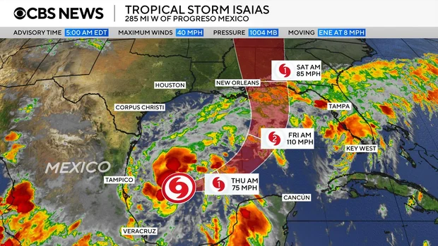










Tropical Storm Isaias is rapidly gaining strength in the Gulf of Mexico, with forecasters projecting it will reach hurricane status by Thursday. The system, which developed from Tropical Depression Nine, is expected to make landfall along the northern Gulf Coast of the United States between late Friday and early Saturday.
Pronounced “ees-ah-EE-ahs,” the storm is currently tracking north of Mexico’s Yucatan Peninsula. As it moves toward the U.S. coast, the National Hurricane Center has issued a series of warnings. A hurricane watch is in effect from Bay St. Louis, Mississippi, to Indian Pass, Florida, while tropical storm watches cover areas from Bay St. Louis to the Jefferson/Plaquemines Parish line in Louisiana and from Indian Pass to the Aucilla River in Florida. Additionally, a storm surge watch extends from the mouth of the Mississippi River to Yankeetown, Florida.
Early Wednesday evening, the storm maintained maximum sustained winds of 65 mph, with tropical-storm-force winds extending outward up to 60 miles. By Thursday morning, meteorologists expect these winds to exceed the 74 mph threshold required for classification as a hurricane. This event would mark the ninth named storm and the first hurricane of the 2026 Atlantic season, which concludes on November 30. Which ends Nov, the storm formed with less than two months remaining in the 2026 hurricane season. A storm’s maximum wind speed must rise to at least 74 mph to be considered a hurricane.
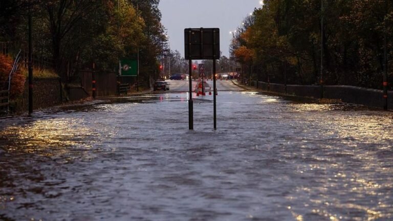
Projections indicate the storm could bring 3 to 6 inches of rainfall to the central Gulf Coast, with some isolated locations experiencing up to 10 inches. This heavy precipitation is expected to impact areas from southeastern Louisiana to the Florida Panhandle throughout the weekend, potentially causing urban and river flooding. Longer-range models suggest the moisture could eventually reach the Ohio Valley and the Northeast by the middle of next week.
Authorities have warned of significant risks, including dangerous winds and a potential storm surge of up to 7 feet at high tide in the 300-mile stretch between Ocean Springs, Mississippi, and Indian Pass, Florida. Residents across Louisiana, Alabama, Mississippi, and northern Florida are urged to finalize their emergency preparations and monitor official weather forecasts closely.
In response to the threat, Florida Governor Ron DeSantis signed an executive order on Tuesday declaring a state of emergency for 25 counties to ensure resources are available for the Panhandle and Big Bend regions. Alabama Governor Kay Ivey followed suit on Wednesday, issuing a state of emergency for 40 counties to facilitate necessary preparations ahead of the storm. Saying in a statement this will allow Alabama officials “to take any needed steps ahead of landfall, kay Ivey issued a similar state of emergency for 40 counties.
The name Isaias occupies a significant spot in meteorological record-keeping, as “I”-named storms in the Atlantic basin are frequently retired due to their severity. Notable retired predecessors include Irene (2011), Irma (2017), Ida (2021), and Ian (2022). Isaias was added to the rotating six-year list of names after Ike was retired in 2008.
Beyond the weather developments, international and investigative news continues to unfold. Mexico has reported the arrest of a suspected cartel leader and fuel smuggler known as “The Tank.” Meanwhile, researchers investigating the disappearance of Amelia Earhart are examining a mysterious object located in the Pacific, and reports indicate that Venezuelan leader Nicolás Maduro may face new charges regarding the alleged torture of American citizens in state prisons. The Scientists Who Want to Steer Hurricanes.